


Communities on edge as new cyclone threat looms
Flood-affected communities in far north Queensland remain on high alert as a new tropical system strengthens offshore, only weeks after Cyclone Narelle battered the region.
Forecasters say Tropical Low 37U, located between Papua New Guinea and the Solomon Islands, is expected to become a cyclone by Sunday amid highly favourable conditions in the Coral Sea.
Key Points
- Tropical Low 37U formed in the Solomon Sea and may become a cyclone by Sunday
- Forecasters warn of multiple tracks, including a threat to north Queensland
- European model suggests approach to far north Queensland coast on Saturday
- Other models keep system about 1000km offshore or shift it toward New Caledonia
- Bureau says Coral Sea conditions are “very favourable” for development
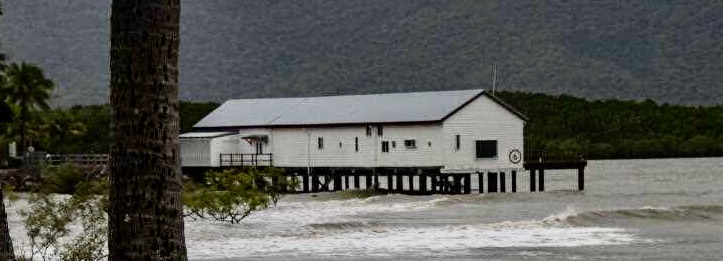
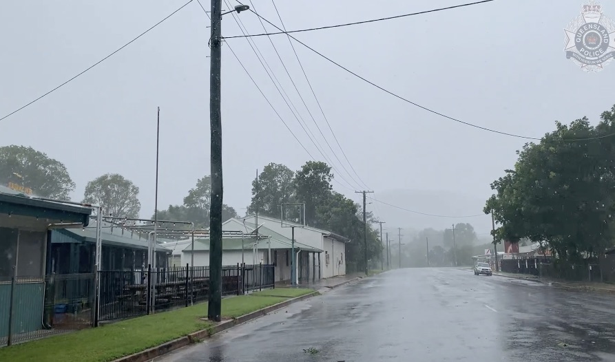
- Communities remain in recovery mode after Cyclone Narelle’s destruction
- Calls grow for cyclone shelters and reliable communications after outages
Senior forecaster Jonathan How said conditions in the Coral Sea were supportive of further cyclone development. The tropical low has formed in the Solomon Sea and is forecast to intensify over the weekend and into early next week, with movement likely to begin from Monday.
The Bureau of Meteorology has identified Tropical Low 37U and advised that it has a moderate (25-45 per c ent) chance of becoming a tropical cyclone from Saturday, increasing to a high (55-60 per cent) chance from Sunday.
Officials continue to emphasise that there remains a range of possible scenarios regarding the system’s path and timing.
Forecast models
The Bureau of Meteorology expects the system to drift towards the south to southwest on Monday and Tuesday, bringing it into the Coral Sea.
From that point, forecast guidance diverges sharply. The European model, one of the major global forecast systems, indicates the system could continue west and likely approach the far north Queensland coast on Saturday.
Other leading models suggest the developing cyclone could remain about 1000km from the Queensland coast or track eastwards toward New Caledonia, underscoring the high uncertainty that persists mid-week.
Mr How cautioned that, while the European model currently shows a potential crossing of the Queensland coast as a strong cyclone, it represents just one of several plausible scenarios.
Sea surface temperatures across the Coral Sea are currently described as “around 30 degrees plus,” more than warm enough to support development and potential intensification. Mr How noted that sea surface temperatures are the dominant influence on whether the system strengthens.
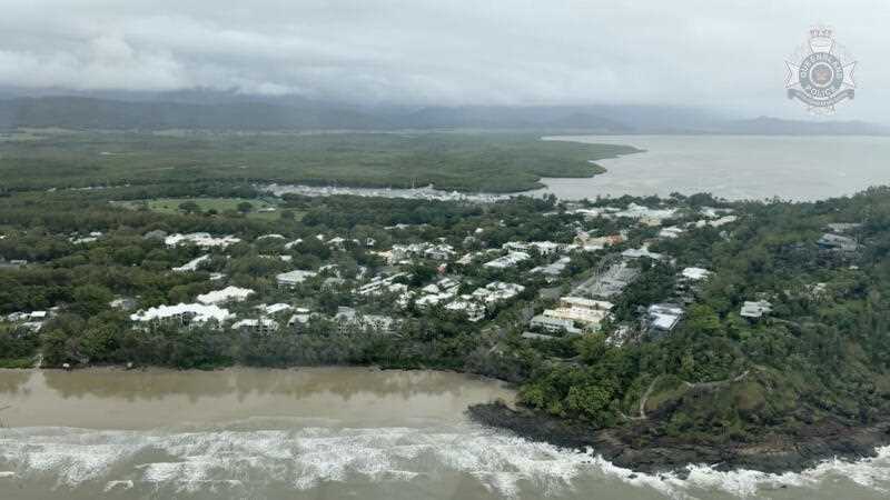
Communities on edge
Across far north Queensland, communities remain focused on clean-up and recovery from Cyclone Narelle. Residents are still in “recovery mode,” with damage assessments underway alongside paperwork and formal funding activations. Local authorities say ongoing uncertainty around the new system complicates planning and resource allocation.
Cook Shire Mayor Robyn Holmes said the community is closely monitoring the developing situation. She noted it remains unclear whether the system will have an impact on the Queensland coast and that it has not yet fully formed.
Local leaders describe a challenging recovery landscape following Narelle, with essential services and assessments ongoing while communities brace for possible further severe weather.
The prospect of a second cyclone within three weeks would mark the shortest interval between direct strikes in Queensland since Cyclones Anthony and Yasi in early 2011.
aap